Skyview Airpark
WY05 · Cheyenne, Wyoming
Airport and flying
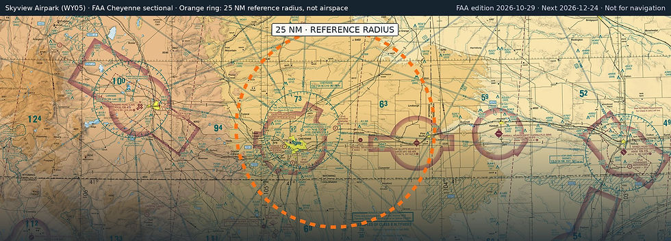
Skyview Airpark (WY05) is a private, non-towered airport in Cheyenne, Laramie County, Wyoming. Field elevation is 5,838 ft. Runway 08/26 is 3,900 by 70 ft, turf / gravel. No fuel is listed on the field.
Nearest fuel: Cheyenne Regional/Jerry Olson Field (CYS, Cheyenne), 10.8 nm W, 9,270 ft runway, 100LL, Jet A, Jet A-1; Pine Bluffs Municipal (82V, Pine Bluffs), 20.8 nm E, 5,330 ft runway, 100LL; Kimball Municipal/Robert E Arraj Field (IBM, Kimball), 41.1 nm E, 6,199 ft runway, 100LL, Jet A.
Major airports: Denver International (DEN, Denver), 81.5 nm S, 16,000 ft runway, 100LL, Jet A; Yampa Valley (HDN, Hayden), 127.4 nm W, 10,000 ft runway, 100LL, Jet A.
Regional airports: Cheyenne Regional/Jerry Olson Field (CYS, Cheyenne), 10.8 nm W, 9,270 ft runway, 100LL, Jet A, Jet A-1; Laramie Regional (LAR, Laramie), 49.4 nm W, 8,503 ft runway, 100LL, Jet A; Northern Colorado Regional (FNL, Fort Collins/Loveland), 49.9 nm SW, 8,500 ft runway, 100LL, Jet A.
Nearby airports: Michael Skypark (WY45, Hillsdale), 6.9 nm SE, 2,042 ft runway; Cheyenne Regional/Jerry Olson Field (CYS, Cheyenne), 10.8 nm W, 9,270 ft runway, 100LL, Jet A, Jet A-1; Morrison (WY02, Carpenter), 11.8 nm SE, 1,738 ft runway; Radio Ranch (WY46, Cheyenne), 13.9 nm SW, 1,855 ft runway.
Official FAA airport record (WY05) · FAA data effective 2026-10-29