Desert Aire Regional
M94 · Mattawa, Washington
Airport and flying
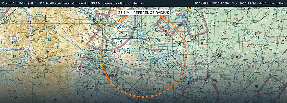
Desert Aire Regional (M94) is a public, non-towered airport in Mattawa, Grant County, Washington. Field elevation is 586 ft. Runway 10/28 is 3,665 by 60 ft, asphalt (excellent condition). No fuel is listed on the field.
Nearest fuel: Sunnyside Municipal (1S5, Sunnyside), 21.7 nm S, 3,425 ft runway, 100LL; Yakima Air Trml/Mcallister Field (YKM, Yakima), 26.7 nm W, 7,604 ft runway, 100LL, Jet A; Prosser (S40), 28.9 nm S, 3,452 ft runway, 100LL.
Major airports: Seattle-Tacoma International (SEA, Seattle), 108 nm NW, 11,901 ft runway, Jet A, Jet A-1; Spokane International (GEG, Spokane), 112.3 nm NE, 11,002 ft runway, 100, 100LL, Jet A.
Regional airports: Yakima Air Trml/Mcallister Field (YKM, Yakima), 26.7 nm W, 7,604 ft runway, 100LL, Jet A; Grant County International (MWH, Moses Lake), 39.8 nm NE, 13,503 ft runway, 100LL, Jet A, Jet A-1+; Tri-Cities (PSC, Pasco), 41.7 nm SE, 7,707 ft runway, 100LL, Jet A-1+.
Nearby airports: Christensen Bros Wahluke Strip (91WA, Mattawa), 5 nm E, 2,500 ft runway; B & G Farms (4WA0, Royal City), 16.3 nm NE, 3,700 ft runway; Mettie Airstrip (Z99, Yakima), 16.9 nm W, 4,600 ft runway; Red Rock Field (2WA2, Royal City), 17.9 nm NE, 3,892 ft runway.
Official FAA airport record (M94) · FAA data effective 2026-10-29