Pine Hollow
32OR · Wamic, Oregon
Airport and flying
Pine Hollow (32OR) is a private, non-towered airport in Wamic, Wasco County, Oregon. Field elevation is 1,820 ft. Runway 07/25 is 2,433 by 125 ft, turf / gravel (fair condition). No fuel is listed on the field.
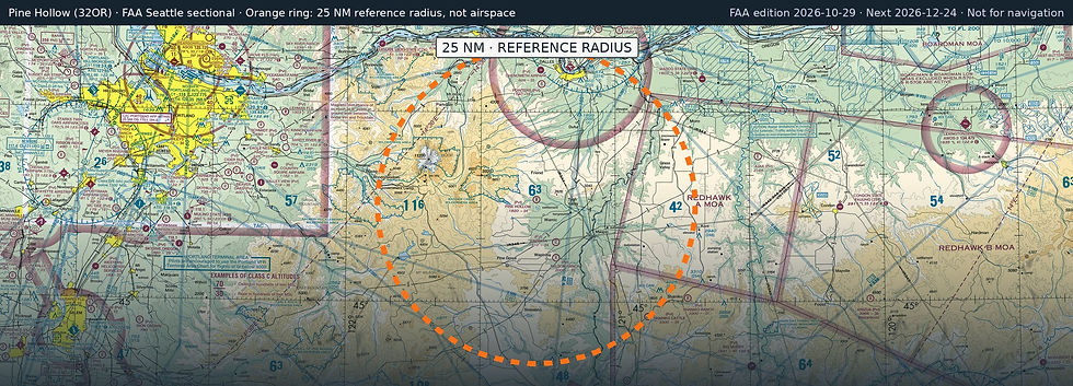
Nearest fuel: Columbia Gorge Regional/The Dalles Municipal (DLS, The Dalles), 22.5 nm N, 5,097 ft runway, 100LL, Jet A-1; Ken Jernstedt Airfield (4S2, Hood River), 27.1 nm N, 3,040 ft runway, 100LL; Madras Municipal (S33, Madras), 35.6 nm S, 5,091 ft runway, 100LL, Jet A.
Major airports: Portland International (PDX, Portland), 58.5 nm W, 11,000 ft runway, 100LL, Jet A; Mahlon Sweet Field (EUG, Eugene), 106.3 nm SW, 8,009 ft runway, 100LL, Jet A.
Regional airports: Roberts Field/Redmond Municipal (RDM, Redmond), 60.4 nm S, 7,038 ft runway, 100LL, Jet A, Mogas; Mcnary Field (SLE, Salem), 75.4 nm W, 5,811 ft runway, 100LL, Jet A; Yakima Air Trml/Mcallister Field (YKM, Yakima), 84.8 nm N, 7,604 ft runway, 100LL, Jet A.
Nearby airports: Wapinitia (OR53), 7.1 nm SE, 2,400 ft runway; Nelson Ranch (19OR, Maupin), 9.2 nm S, 2,500 ft runway; Pointers (6OR1, The Dalles), 19.1 nm N, 1,600 ft runway; Chenoweth Airpark (6OR2, The Dalles), 21.4 nm N, 2,500 ft runway.
Official FAA airport record (32OR) · FAA data effective 2026-10-29