Westport
4F1 · Westport, Oklahoma
Airport and flying
Westport (4F1) is a public, non-towered airport in Westport, Pawnee County, Oklahoma. Field elevation is 901 ft. Runway 03/21 is 2,900 by 42 ft, asphalt (fair condition). No fuel is listed on the field.
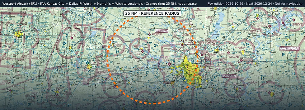
Nearest fuel: William R Pogue Municipal (OWP, Sand Springs), 9.8 nm E, 5,799 ft runway, 100LL, Jet A+; Hominy Municipal (H92, Hominy), 13.4 nm N, 3,210 ft runway, 100LL; Skiatook Municipal (2F6, Skiatook), 18.1 nm NE, 3,002 ft runway, 100LL.
Major airports: Tulsa International (TUL, Tulsa), 22.2 nm E, 10,000 ft runway, 100LL, Jet A; Okc Will Rogers International (OKC, Oklahoma City), 78.8 nm SW, 9,802 ft runway, 100LL, Jet A.
Regional airports: Stillwater Regional (SWO, Stillwater), 36 nm W, 7,401 ft runway, 100LL, Jet A; Northwest Arkansas Ntl (XNA, Fayetteville/Springdale/Rogers), 98.8 nm E, 8,801 ft runway, 100LL, Jet A; Joplin Regional (JLN, Joplin), 105.1 nm NE, 6,502 ft runway, 100LL, Jet A.
Nearby airports: Gull Bay Landing (00OK, Sandsprings), 6.4 nm E, 2,200 ft runway; Cleveland Municipal (95F, Cleveland), 6.8 nm NW, 4,000 ft runway; Flying G Ranch (3OK8, Sand Springs), 8.3 nm SE, 2,640 ft runway; William R Pogue Municipal (OWP, Sand Springs), 9.8 nm E, 5,799 ft runway, 100LL, Jet A+.
Official FAA airport record (4F1) · FAA data effective 2026-10-29