Lake Waltanna
SN65 · Goddard, Kansas
Airport and flying
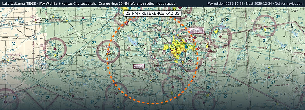
Lake Waltanna (SN65) is a private, non-towered airport in Goddard, Sedgwick County, Kansas. Field elevation is 1,448 ft. Runway 17/35 is 2,100 by 100 ft, turf. No fuel is listed on the field.
Nearest fuel: Wichita Dwight D Eisenhower Ntl (ICT, Wichita), 9.3 nm E, 10,302 ft runway, 100LL, Jet A; Westport (71K, Wichita), 11.5 nm E, 2,520 ft runway, 100LL; Wellington Municipal (EGT, Wellington), 19.4 nm SE, 5,201 ft runway, 100LL, Jet A.
Major airports: Wichita Dwight D Eisenhower Ntl (ICT, Wichita), 9.3 nm E, 10,302 ft runway, 100LL, Jet A; Tulsa International (TUL, Tulsa), 117.9 nm SE, 10,000 ft runway, 100LL, Jet A.
Regional airports: Salina Regional (SLN, Salina), 71.9 nm N, 12,301 ft runway, 100LL, Jet A; Stillwater Regional (SWO, Stillwater), 89.7 nm S, 7,401 ft runway, 100LL, Jet A; Manhattan Regional (MHK, Manhattan), 103 nm NE, 7,400 ft runway, 100LL, Jet A.
Nearby airports: Yoder Airpark (SN61, Goddard), 3.9 nm N, 4,200 ft runway; Weiss Acres (24KS, Viola), 4.2 nm S, 1,270 ft runway; Rucker (SN34, Clearwater), 6 nm E, 2,600 ft runway; Eck Field (SN64, Goddard), 7 nm NE, 2,499 ft runway.
Official FAA airport record (SN65) · FAA data effective 2026-10-29