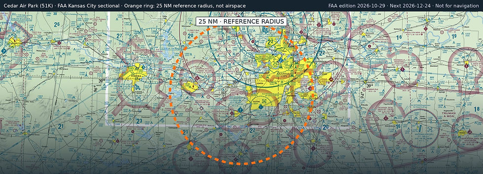
Cedar Air Park
51K · Olathe, Kansas
Airport and flying
Cedar Air Park (51K) is a public, non-towered airport in Olathe, Johnson County, Kansas. Field elevation is 1,024 ft. Runway 17/35 is 2,440 by 75 ft, turf (good condition). No fuel is listed on the field.
Nearest fuel: New Century Aircenter (IXD, Olathe), 6 nm S, 7,339 ft runway, 100LL, Jet A; Gardner Municipal (K34, Gardner), 8.2 nm SW, 3,224 ft runway, 100LL; Johnson County Exec (OJC, Olathe), 8.5 nm SE, 4,097 ft runway, 100LL, Jet A.
Major airports: Kansas City International (MCI, Kansas City), 23.4 nm N, 10,801 ft runway, 100LL, Jet A; Wichita Dwight D Eisenhower Ntl (ICT, Wichita), 142.6 nm SW, 10,302 ft runway, 100LL, Jet A.
Regional airports: Kansas City Downtown/Wheeler Field (MKC, Kansas City), 17.8 nm NE, 6,827 ft runway, 100LL, Jet A; Topeka Regional (FOE, Topeka), 36.4 nm W, 12,803 ft runway, 100LL, Jet A; Rosecrans Meml (STJ, St Joseph), 50.5 nm N, 8,061 ft runway, 100LL, Jet A.
Nearby airports: New Century Aircenter (IXD, Olathe), 6 nm S, 7,339 ft runway, 100LL, Jet A; Ingels Aerodrome (4KS2, De Soto), 6.2 nm NW, 1,700 ft runway; Belleair (1KS9, Bonner Springs), 7.5 nm NW, 1,500 ft runway; Gardner Municipal (K34, Gardner), 8.2 nm SW, 3,224 ft runway, 100LL.
Official FAA airport record (51K) · FAA data effective 2026-10-29