Way West
50II · Bainbridge, Indiana
Airport and flying
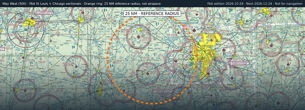
Way West (50II) is a private, non-towered airport in Bainbridge, Putnam County, Indiana. Field elevation is 890 ft. Runway 09/27 is 3,200 by 80 ft, turf. No fuel is listed on the field.
Nearest fuel: Putnam County Regional (GPC, Greencastle), 8.8 nm S, 5,002 ft runway, 100LL, Jet A-1+; Hendricks County-Gordon Graham Field (2R2, Indianapolis), 13.1 nm E, 4,400 ft runway, 100LL, Mogas; Crawfordsville Regional (CFJ, Crawfordsville), 14.3 nm NW, 5,506 ft runway, 100LL, Jet A, Jet A+.
Major airports: Indianapolis International (IND, Indianapolis), 21.6 nm E, 11,200 ft runway, 100LL, Jet A, Jet A-1+; Cincinnati/Northern Kentucky International (CVG, Covington), 106.2 nm SE, 12,001 ft runway, 100LL, Jet A.
Regional airports: Terre Haute Regional (HUF, Terre Haute), 32 nm SW, 9,021 ft runway, 100LL, Jet A; Monroe County (BMG, Bloomington), 38.2 nm S, 6,500 ft runway, 100LL, Jet A; Purdue University (LAF, Lafayette), 39.2 nm N, 6,600 ft runway, 100LL, Jet A.
Nearby airports: Oleo (4II3, Fillmore), 2.6 nm SE, 1,450 ft runway; Hampton Field (38II, Greencastle), 4.1 nm SW, 2,400 ft runway; Layne Field (5II1, New Winchester), 6.4 nm E, 2,800 ft runway; 4 Winds Aerodrome (IN45, Roachdale), 6.6 nm NW, 1,900 ft runway.
Official FAA airport record (50II) · FAA data effective 2026-10-29