Salmon River Airfield
9B8 · Marlborough, Connecticut
Airport and flying
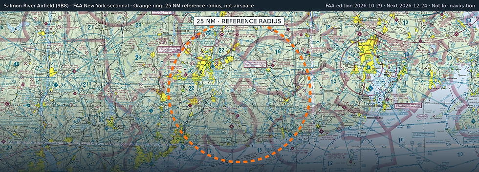
Salmon River Airfield (9B8) is a public, non-towered airport in Marlborough, Hartford County, Connecticut. Field elevation is 540 ft. Runway 17/35 is 2,000 by 60 ft, turf (good condition). No fuel is listed on the field.
Nearest fuel: Chester (SNC), 12.7 nm S, 2,722 ft runway, 100LL; Hartford-Brainard (HFD, Hartford), 12.8 nm NW, 4,417 ft runway, 100LL, Jet A; Windham (IJD, Willimantic), 15 nm NE, 4,271 ft runway, 100LL, Jet A+.
Major airports: Bradley International (BDL, Windsor Locks), 23.6 nm NW, 9,510 ft runway, 100LL, Jet A; Tweed/New Haven (HVN, New Haven), 28 nm SW, 5,600 ft runway, 100LL, Jet A.
Regional airports: Groton-New London (GON, Groton (New London)), 23.7 nm SE, 5,000 ft runway, 100LL, Jet A; Westfield-Barnes Regional (BAF, Westfield/Springfield), 36.3 nm N, 9,000 ft runway, 100LL, Jet A; Westover Arb/Metro (CEF, Springfield/Chicopee), 36.5 nm N, 11,597 ft runway, 100LL, Jet A.
Nearby airports: Rankl Field (CT20, Marlborough), 0.8 nm NE, 1,600 ft runway; Skis Landing Area (CT07, Colchester), 6.3 nm E, 1,500 ft runway; Goodspeed (42B, East Haddam), 8.7 nm S, 4,500 ft runway; Devils Hopyard Field (CT11, East Haddam), 9.9 nm SE, 1,250 ft runway.
Official FAA airport record (9B8) · FAA data effective 2026-10-29