Holley Mountain Airpark
2A2 · Clinton, Arkansas
Airport and flying
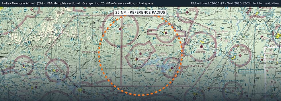
Holley Mountain Airpark (2A2) is a public, non-towered airport in Clinton, Van Buren County, Arkansas. Field elevation is 1,270 ft. Runway 05/23 is 4,795 by 50 ft, asphalt (good condition). No fuel is listed on the field.
Nearest fuel: Clinton Municipal (CCA, Clinton), 3.9 nm SW, 4,007 ft runway, 100LL; Buffalo River (4A5, Marshall), 19.3 nm NW, 4,003 ft runway, 100LL; Mountain View Wilcox Meml Field (7M2, Mountain View), 19.9 nm NE, 4,502 ft runway, 100LL.
Major airports: Bill And Hillary Clinton Ntl/Adams Field (LIT, Little Rock), 56 nm S, 8,273 ft runway, 100LL, Jet A; Frederick W Smith International/Memphis (MEM, Memphis), 124.3 nm E, 11,120 ft runway, 100LL, Jet A, Jet A+, Jet A++.
Regional airports: Branson (BBG), 65.5 nm NW, 7,140 ft runway, 100LL, Jet A, Jet A+; Meml Field (HOT, Hot Springs), 78.2 nm SW, 6,595 ft runway, 100LL, Jet A; Drake Field (FYV, Fayetteville), 88.6 nm W, 6,005 ft runway, 100LL, Jet A.
Nearby airports: Clinton Municipal (CCA, Clinton), 3.9 nm SW, 4,007 ft runway, 100LL; Cy Bond Meml (06AR, Higden), 12.4 nm SE, 2,900 ft runway; Skypoint Estates (33AR, Greers Ferry), 13.1 nm E, 2,300 ft runway; Diamond Bluff (1AR6, Greers Ferry), 13.4 nm SE, 2,600 ft runway.
Official FAA airport record (2A2) · FAA data effective 2026-10-29