Triangle Airpark
AZ50 · White Hills, Arizona
Airport and flying
Triangle Airpark (AZ50) is a private, non-towered airport in White Hills, Mohave County, Arizona. Field elevation is 2,460 ft. Runway 17/35 is 3,900 by 50 ft, asphalt. Runway 08/26 is 1,844 by 50 ft, dirt. No fuel is listed on the field.
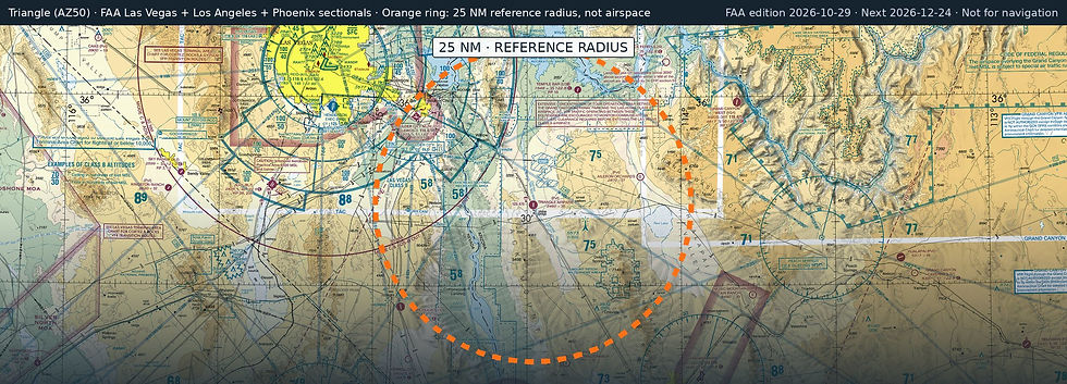
Nearest fuel: Boulder City Municipal (BVU, Boulder City), 23.2 nm NW, 5,103 ft runway, 100LL, Jet A; Laughlin/Bullhead International (IFP, Bullhead City), 34 nm S, 8,501 ft runway, 100LL, Jet A; Henderson Exec (HND, Las Vegas), 35.4 nm NW, 6,501 ft runway, 100LL, Jet A.
Major airports: Harry Reid International (LAS, Las Vegas), 39.3 nm NW, 14,835 ft runway, 100, 100LL, Jet A-1+; Palm Springs International (PSP, Palm Springs), 151.1 nm SW, 10,000 ft runway, 100LL, Jet A.
Regional airports: Laughlin/Bullhead International (IFP, Bullhead City), 34 nm S, 8,501 ft runway, 100LL, Jet A; Grand Canyon West (1G4, Peach Springs), 36.1 nm NE, 5,000 ft runway; St George Regional (SGU, St George), 92.1 nm NE, 9,300 ft runway, 100LL, Jet A.
Nearby airports: White Hills (04AZ), 1.5 nm E, 8,968 ft runway; Aileron Orchards (AZ49, Dolan Springs), 17.5 nm E, 2,700 ft runway; Temple Bar (U30), 19.6 nm N, 3,500 ft runway; Boulder City Municipal (BVU, Boulder City), 23.2 nm NW, 5,103 ft runway, 100LL, Jet A.
Official FAA airport record (AZ50) · FAA data effective 2026-10-29